
New London ZIP Code Directory Map
The New London ZIP code directory has one clear city delivery ZIP and one nearby label that needs care. USPS, Census geography, municipal records, and voter records use different boundaries. The table below separates the ordinary New London mailing area from the Quaker Hill regional label and from nearby county ZIPs. Use it as a starting map, then test any specific address through USPS.
| ZIP Code | Areas Covered | Post Office | Notes |
|---|---|---|---|
| 06320 | New London, including ordinary city delivery addresses | New London Post Office, 27 Masonic St Ste 1 | Primary USPS ZIP for the City of New London |
| 06375 | Quaker Hill and nearby regional labeling | Regional USPS and state-service listings | Not the ordinary city delivery ZIP; verify address by address |
| Adjacent ZIPs | Waterford, Groton, Gales Ferry, and other New London County communities | Separate local post offices | Nearby service areas are not extra New London city delivery ZIPs |
06320 is the primary New London city delivery ZIP. 06375 can appear beside New London in regional or statistical results because Quaker Hill is close and ZIP and ZCTA geography do not follow the city line. A search result that names a postal city should be kept separate from the municipality named in a parcel or voter record.
06320 serves New London ZIP mail
The New London Post Office is at 27 Masonic Street, Suite 1, New London, Connecticut 06320-9998. The location listing records weekday hours of Monday through Friday, 8 to 5, and Saturday, 8 to 1. Those hours describe the post-office counter, not the hours of the City Clerk, assessor, registrars, or a private records collection. For a person or parcel question, use USPS to confirm the address first and then use the custodian whose record you need.
The USPS address result does not confirm that a person or company is at an address. It confirms a postal assignment. The New London assessor, MapGeo, and the voter street list answer different questions about the same street. Keep the result date, postal city, ZIP, municipal name, and parcel key in separate fields.
The USPS New London Post Office listing supplies the local counter address and hours used when an online ZIP check needs an in-person fallback.
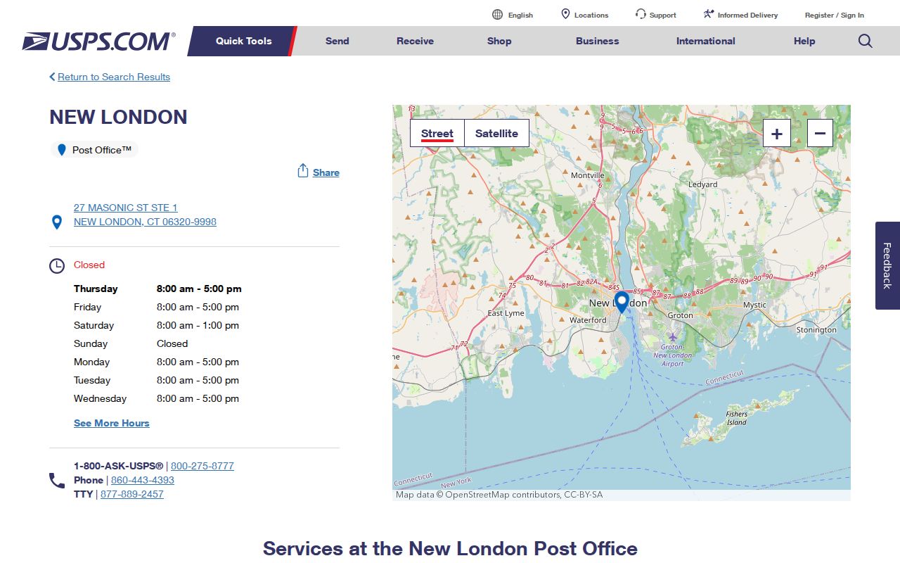
The post office listing is a service-location source. It is not a directory of New London residents.
06375 and New London ZIP boundaries
06375 is the Quaker Hill label encountered in regional and state-service material. It is important to New London ZIP research because a nearby postal or Census label can look like a city boundary. The research does not support treating 06375 as an ordinary New London city delivery ZIP. When a result uses Quaker Hill, check the street address, municipality, tax parcel, and voter district before calling it a New London address.
Census ZCTA5 areas are statistical approximations, not legal boundaries. DMV office listings can also place New London and Quaker Hill labels close together without changing the city line. Waterford and Groton can be physically near a New London parcel while remaining separate municipal record jurisdictions. A ZIP code directory should describe that overlap, not flatten it.
Note: A postal city, a ZIP, a ZCTA, a tax town, and a voting district can point to the same street while naming different geographies.
Narrow New London residents by ZIP
A ZIP-aware resident search needs a two-part check. First verify the postal assignment. Then choose a public record that actually accepts the clue. The Connecticut voter lookup uses town, first name, last name, and date of birth, not a ZIP-only roster. Vision offers address, owner, account, MBLU, PID, and all-field modes but no dedicated ZIP-wide search was exposed. eLicense does expose a ZIP field, though it returns credential records rather than a household list.
- Run USPS ZIP Code by Address with the street, city, and state. Add the apartment or ZIP only when the form calls for it.
- Write down the postal city and result date, then compare the municipality with the New London parcel or official street record.
- Use Vision by Address, Owner, MBLU, or PID for a parcel question, or use SOTS town and name fields for a voter-status question.
- Use eLicense when the question concerns a state credential or public business address. Do not turn that result into a residence claim.
- Once the ZIP narrows the street, move to the New London Street Directory for address-keyed parcel and street records.
The sequence matters because there is no single public ZIP roster for every New London household. A result from one system should retain its own purpose and limits. A ZIP narrows geography; it does not replace a name, address, parcel ID, voter match, or custodian request.
Use USPS for New London ZIP lookup
The USPS ZIP Code Lookup offers three distinct modes. The first tests one street address. The second lists ZIPs associated with a city and state. The third starts with a ZIP and returns recognized or recommended city names. The result area is dynamic and was labeled “Showing Results” in the inspection. No export or pagination control was visible, and a stable live result for the New London ZIPs was not captured.
| USPS mode | Required fields | Optional fields | What the result means |
|---|---|---|---|
| ZIP Code by Address | Street Address, City, State | Company, Apt/Suite/Other, ZIP | Postal assignment for the entered address |
| ZIP Code by City and State | City, State | None captured | ZIP list that may serve that city name |
| Cities by ZIP Code | ZIP | None captured | Recognized or recommended city names |
The USPS lookup page shows the three search paths that keep an address check distinct from a city or ZIP label check.
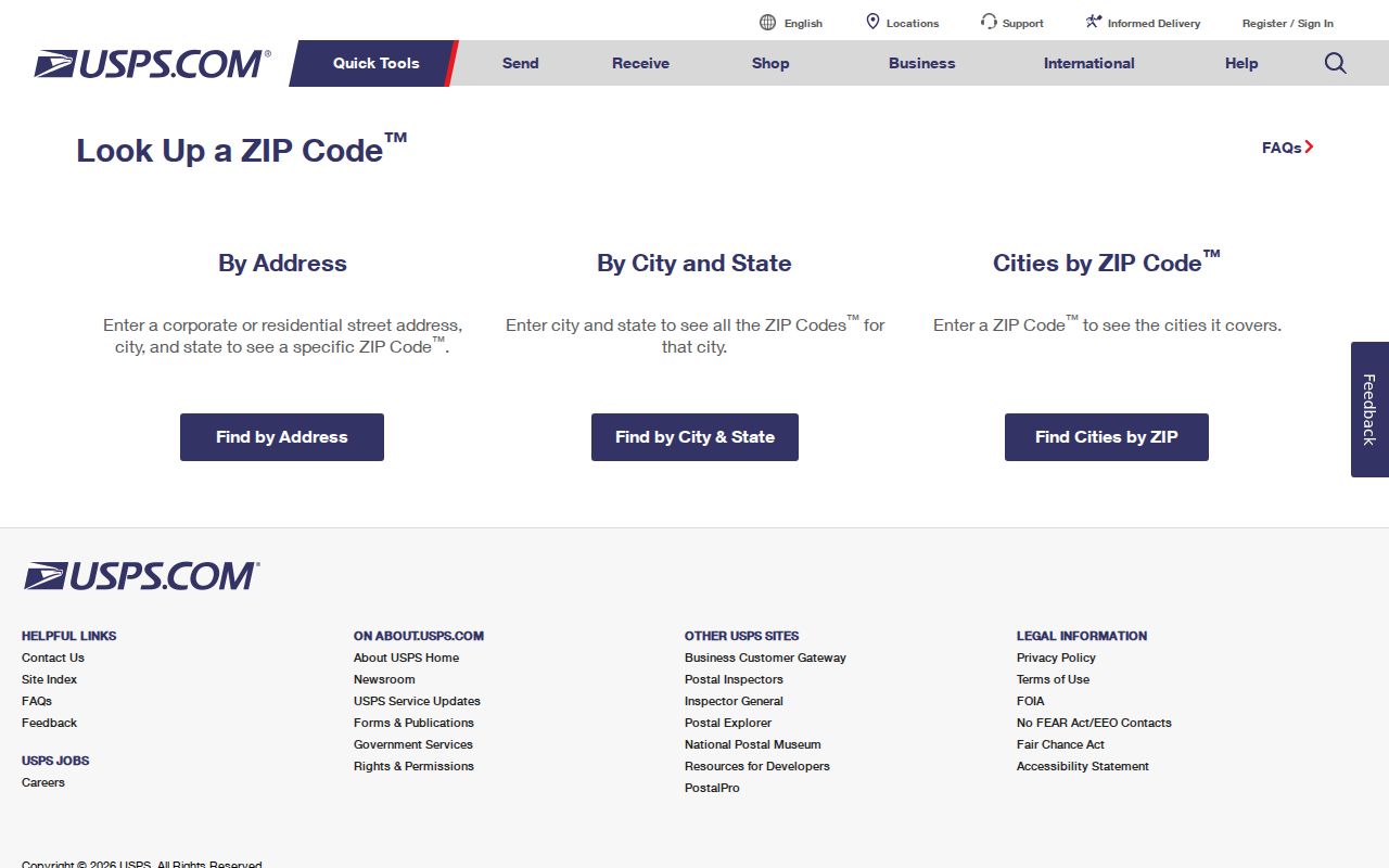
Use the address mode for a particular parcel, the city and state mode for a service-area question, and the ZIP mode for postal city labels.
Which New London tools accept ZIP fields
Local systems do not all treat ZIP as a search key. Vision’s public search source accepts Address, Owner, Acct#, MBLU, PID, and All, with MBLU components for map, map cut, block, block cut, lot, unit, and unit cut. No ZIP mode was visible. MapGeo’s Quick Search is a dynamic property map, but a ZIP filter was not exposed in text. The SOTS voter lookup asks for town and identity fields. The eLicense form is the clearest ZIP-capable comparison because its public controls include address, state, city, ZIP, license type, status, name, business, and country.
The Connecticut eLicense lookup demonstrates a ZIP field inside a credential search, not a resident-directory search.
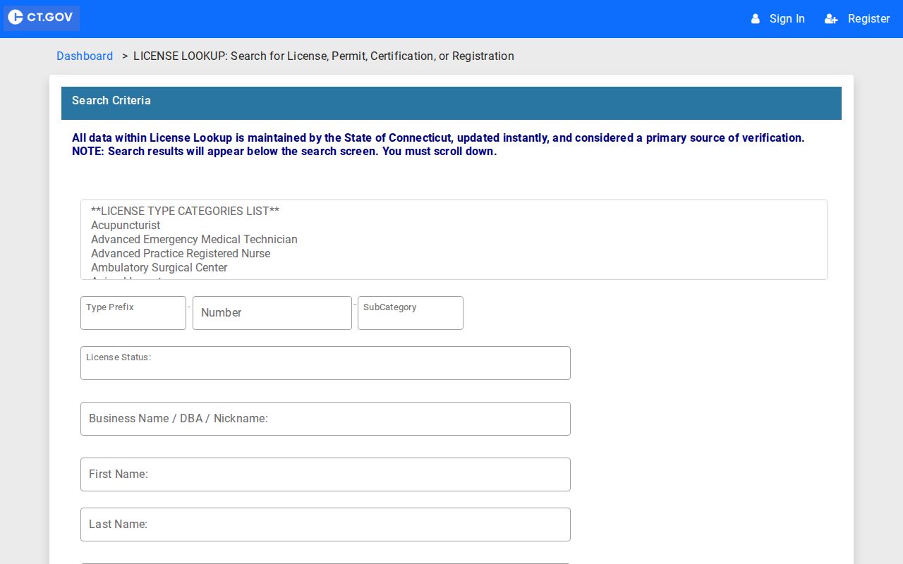
The eLicense screen is useful for credential geography, while its status and detail fields remain tied to a license record.
New London’s 311 request form captures a Postal Code for a submitted location, but it is a service-request intake, not a public ZIP directory. The image from the New London 311 request form helps show that difference.
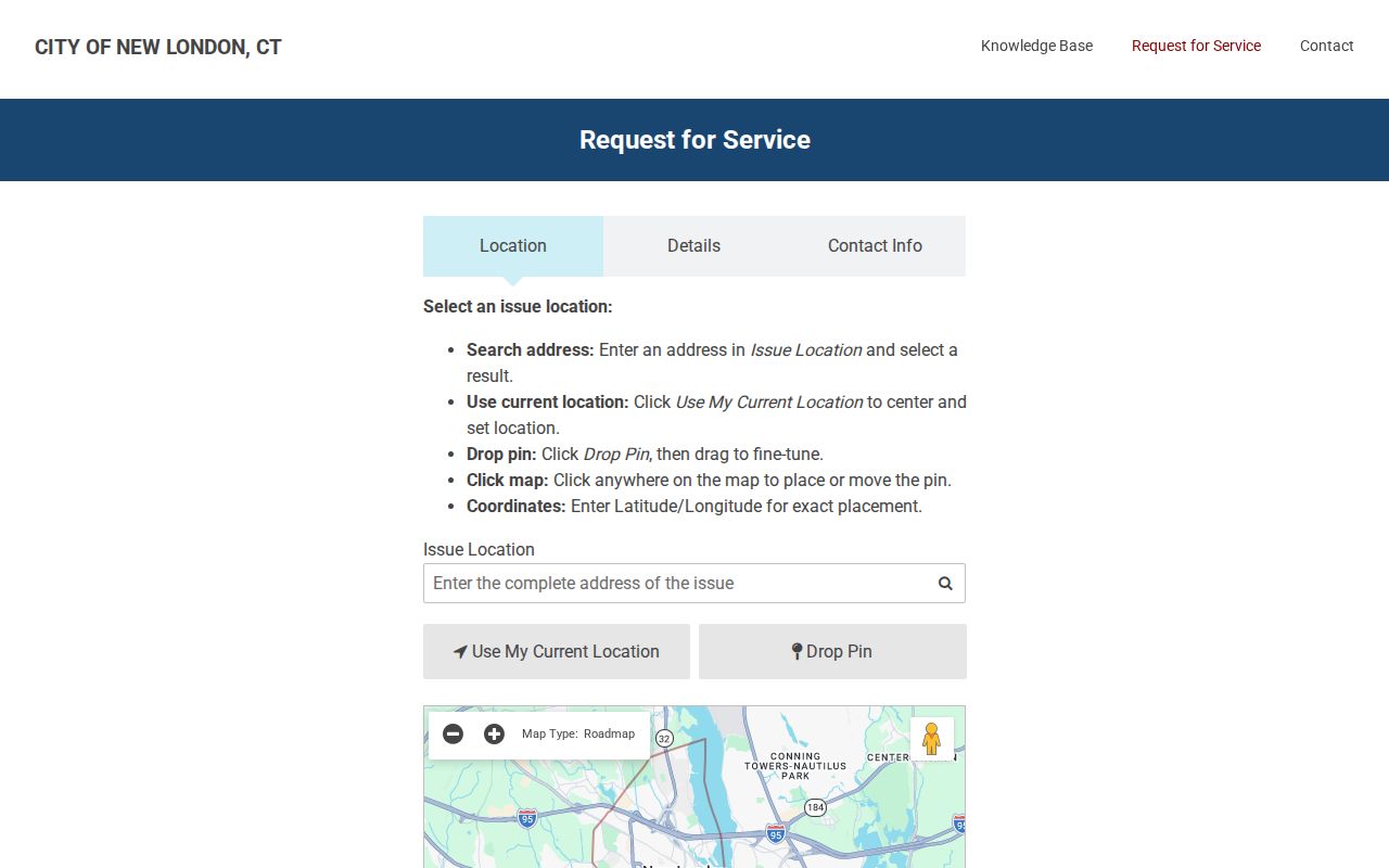
For a city record, ask the assessor, GIS staff, registrars, or 311 custodian what the ZIP field means in that system before treating it as a coverage filter.
New London ZIP boundaries versus city lines
A New London ZIP code can sit beside a city line without tracing it. The situs address locates the parcel. The assessor PID or MBLU identifies the tax parcel. The deed’s legal description controls the title trail. The voter street list assigns a district by number and parity. USPS assigns delivery geography. MapGeo and SECOG add parcel geometry, but both carry accuracy and boundary cautions.
The PID 987 MBLU example, written as H24/ 32/ 13/ /, shows why a street label alone can miss the exact parcel. For a boundary question, record the postal city, municipal name, ZIP, parcel ID, MBLU, legal description, and voting district as separate values. If one says Waterford, Groton, or Quaker Hill, do not silently rewrite it as New London.
- ZIP versus ZIP+4
- A ZIP identifies a postal delivery area. ZIP+4 adds a more precise delivery segment to that base ZIP.
- PO-box ZIP
- A ZIP used for post-office boxes or a limited postal service area, not proof of a parcel boundary.
- Unique ZIP
- A postal code assigned to a single organization or large delivery point rather than a broad neighborhood.
- Carrier route
- A delivery sequence within a postal area, used for mail service rather than city or tax jurisdiction.
- ZCTA
- A Census statistical approximation built from ZIP-like geography, not a legal municipal line.
New London ZIP history needs a bridge
An old postal label can hide a changed street name, number, town reference, or parcel shape. Compare a city directory page with the Sanborn sequence for New London from 1884, 1891, 1896, 1901, 1907, 1912, and 1921, including the 1921 material republished in 1954. New London Landmarks keeps address-organized building files with photographs, clippings, maps, plans, and building histories. PLNL and the New London County Historical Society can help match a street spelling or earlier number.
The historical layer is a research fallback, not a ZIP roster. Use a directory year to identify an occupant or business, a Sanborn sheet to test the block and building footprint, and a legal description or MBLU to connect the old address to the current parcel. When the postal line and city line seem to disagree, ask the City Clerk, GIS or Planning staff, USPS, library, or historical society a narrow address question.
Note: Preserve the postal city and the municipal city exactly as each source prints them; the difference may be the key to an older address.
New London ZIP terms for research
Online access is only the first channel. USPS offers the lookup and the post-office counter. New London’s assessor, MapGeo, registrars, City Clerk, and 311 staff hold different address fields. State OPM and Census material can add regional context, while the DMV location list can explain nearby labels. For older addresses, visit or contact PLNL, Landmarks, NLCHS, or the State Library. Use a focused mail, email, appointment, or reproduction request for a directory page or map.
A Connecticut FOI request under CGS §§1-200 through 1-259 can seek eligible municipal maps or administrative correspondence, but it does not turn a postal label into a resident list. Call USPS or New London GIS and Planning when a street assignment is unclear. Keep the USPS result date, parcel key, and source name together. That record trail is more reliable than assuming a ZIP code directory has one master boundary.